Supplementary Maps
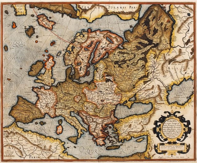
Karte 1: Europa aus: Atlas der Gerhard Mercator (1595)
Atlas des Gerhard Mercator
Karte 2: Europa 1580 (IEG Mainz)
Europa 1580

http://www.ieg-maps.uni-mainz.de/mapsp/mappEu580_Serie2.htm
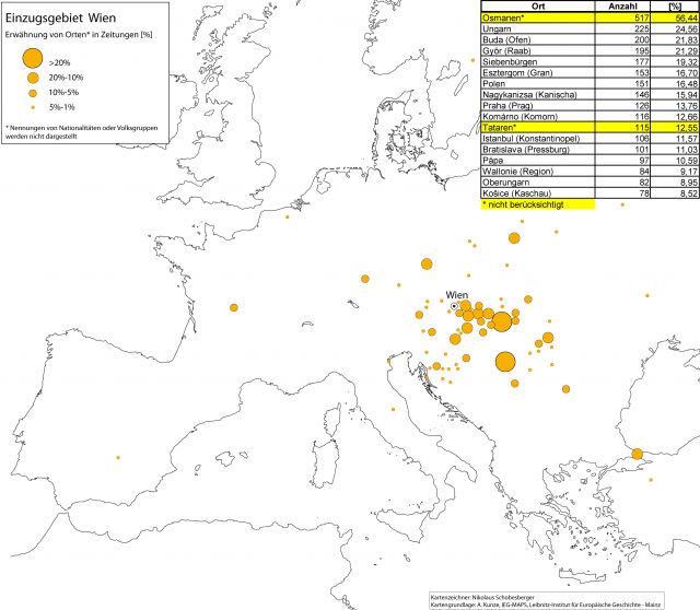
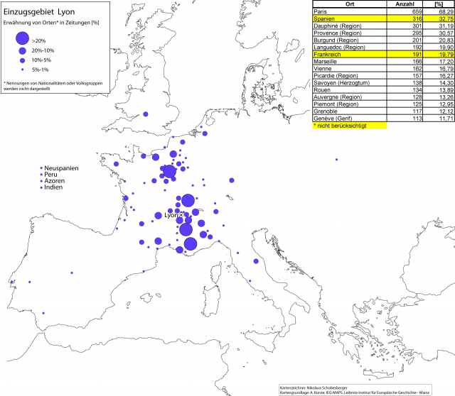
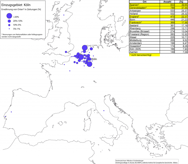
Maps 3 to 9: These maps created by Nikolaus Schobesberger depicts the catchment area of the seven most important places of origin of newspapers. The places of origin were in most cases centers of collection of information coming from relatively clearly recognizable regions (the so-called catchment areas). In theses centers, news from the catchment areas were summarized, and a newspaper was created and circulated. In so doing news from the catchment areas became also part of other news-swapping networks. The integrated tables contain basic numerical data, which refer to all places of origin mentioned in the newspapers coming from one place of origin. However, mentions of “States” and general descriptions like “The Ottomans” have not been considered in our cartographical analysis, because they often refer to names of troops or similar references, thus are not relevant for a geographical analysis.
Einzugsgebiet Antwerpen

Einzugsgebiet Venedig

Einzugsgebiet Wien
Einzugsgebiet Lyon
Einzugsgebiet Prag

Einzugsgebiet Köln
Einzugsgebiet Rom

Map 10 interconnects these information centers by drawing lines based on various hints in the newspapers. The net of information resulting is centered in Augsburg, the heart of the brothers Fugger mail network, and connects at the same time Augsburg to the European postal routes as they existed around 1600.
Informationsnetz
